SLAMM: Sea Level Affecting Marshes Model
The Sea Level Affecting Marshes Model (SLAMM) simulates the dominant processes involved in wetland conversions and shoreline modifications during long-term sea level rise. Map distributions of wetlands are predicted under conditions of accelerated sea level rise, and results are summarized in tabular and graphical form. The newest versions of SLAMM include a Roads module to investigate the inundation frequency of road infrastructure and a stochastic uncertainty analysis module for asessing the effects of input data uncertainty on model predictions. The uncertainty analysis module can be used to produce confidence intervals for model predictions and likelihood maps.
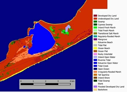
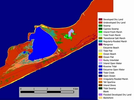
Sample SLAMM output for Montauk, NY (project funded by NYSERDA)
Left panel shows the initial wetland conditions, the right panel presents the wetlands predicted by SLAMM at 2055 under a scenario of 1m of sea-level rise by 2100.
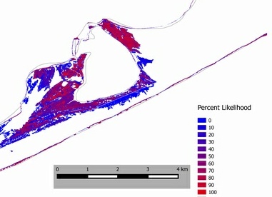
Pecent Likelihood of landcover change by 2055 under 1m sea-level rise by 2100. This provides a visual estimate of uncertainty to accompany the results presented above.
|